Home
Maps of the World: An Illustrated Children's Atlas Adventure, Culture, and Discovery
Barnes and Noble
Loading Inventory...
Maps of the World: An Illustrated Children's Atlas Adventure, Culture, and Discovery
Current price: $24.99
Barnes and Noble
Maps of the World: An Illustrated Children's Atlas Adventure, Culture, and Discovery
Current price: $24.99
Loading Inventory...
Size: Hardcover
*Product information may vary - to confirm product availability, pricing, shipping and return information please contact Barnes and Noble
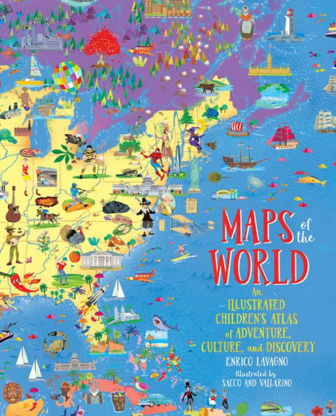
Discover the mysteries of the world with this lavishly illustrated, fact-filled, oversized atlas that allows children to discover the world without leaving home.
Covering every continent, country, even outer space,
Maps of the World
is a vibrant and comprehensive atlas that children of all ages will love to explore.
The dozens of colorful, detailed maps are filled with charming, educational icons representing the aboriginal people in Australia, giant tortoises in the Galapagos, the Gold Rush in California, traditional dress in Mali, and even James Bond in England. Flip the next page in the book, and the corresponding icon key explains hundreds of these cultural, environmental, and societal illustrations. Organized by continent, the atlas also includes details on populations, language, agricultural, politics, and other bite-size facts.
Each map includes a link allowing kids to download a version of them on computers and tablets to explore even further. Captivating and comprehensive,
will entice even the most reluctant young explorer.