Home
Spain and Portugal
Barnes and Noble
Loading Inventory...
Spain and Portugal
Current price: $14.95
Barnes and Noble
Spain and Portugal
Current price: $14.95
Loading Inventory...
Size: OS
*Product information may vary - to confirm product availability, pricing, shipping and return information please contact Barnes and Noble
• Waterproof • Tear-Resistant • Travel Map
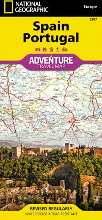
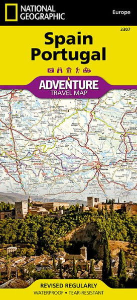
National Geographic's Spain and Portugal Adventure Map is designed to meet the unique needs of adventure travelers with its detailed and accurate information. Cities and towns are clearly indicated and easy to find in the user-friendly index. A road network complete with distances and designations for motorways, expressways, and secondary routes will help you find the route that's right for you. Specialty content to include hundreds of diverse and unique recreational, ecological, cultural, and historical destinations, make this map invaluable to travelers hoping to experience all the attractions the countries have to offer.
The eastern half of the Spain/Portugal map shows the eastern half of Spain from its northern borders with France and Andorra south along its Mediterranean coastline to Almera. Portugal and the western half of Spain including the Canary Islands are covered on the other half of the map.
The neighboring countries of Spain and Portugal were both powerful empires at one time whose discoveries, conquests, and cultures greatly influenced the course of world history. With the opening of trade routes and the colonization of the Americas, Spain and Portugal not only brought their languages, religion, art, literature, music, and architecture to regions across the globe, they introduced new agricultural products, spices, and knowledge of the geography and peoples of the world to Europe. Vacationers enjoy Spain and Portugal's lovely islands and extensive coastal beaches, as well as the plethora of historical sites, museums, and striking architectural masterpieces found in their sunny cities.
Every Adventure Map is printed on durable synthetic paper, making them waterproof, tear-resistant and tough — capable of withstanding the rigors of international travel.
Map Scale = 1:1,000,000
Sheet Size = 25.5" x 37.75"
Folded Size = 4.25" x 9.25"
• Waterproof • Tear-Resistant • Travel Map
National Geographic's Spain and Portugal Adventure Map is designed to meet the unique needs of adventure travelers with its detailed and accurate information. Cities and towns are clearly indicated and easy to find in the user-friendly index. A road network complete with distances and designations for motorways, expressways, and secondary routes will help you find the route that's right for you. Specialty content to include hundreds of diverse and unique recreational, ecological, cultural, and historical destinations, make this map invaluable to travelers hoping to experience all the attractions the countries have to offer.
The eastern half of the Spain/Portugal map shows the eastern half of Spain from its northern borders with France and Andorra south along its Mediterranean coastline to Almera. Portugal and the western half of Spain including the Canary Islands are covered on the other half of the map.
The neighboring countries of Spain and Portugal were both powerful empires at one time whose discoveries, conquests, and cultures greatly influenced the course of world history. With the opening of trade routes and the colonization of the Americas, Spain and Portugal not only brought their languages, religion, art, literature, music, and architecture to regions across the globe, they introduced new agricultural products, spices, and knowledge of the geography and peoples of the world to Europe. Vacationers enjoy Spain and Portugal's lovely islands and extensive coastal beaches, as well as the plethora of historical sites, museums, and striking architectural masterpieces found in their sunny cities.
Every Adventure Map is printed on durable synthetic paper, making them waterproof, tear-resistant and tough — capable of withstanding the rigors of international travel.
Map Scale = 1:1,000,000
Sheet Size = 25.5" x 37.75"
Folded Size = 4.25" x 9.25"