Home
Atlanta GA Regional Map
Barnes and Noble
Atlanta GA Regional Map
Current price: $9.99

Barnes and Noble
Atlanta GA Regional Map
Current price: $9.99
Size: OS
Loading Inventory...
*Product information may vary - to confirm product availability, pricing, shipping and return information please contact Barnes and Noble
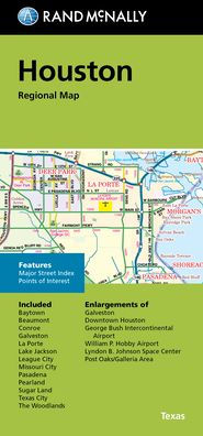
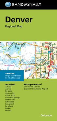
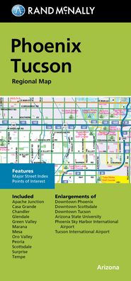
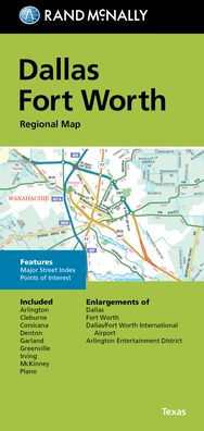
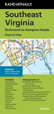
Rand McNally's folded map for Atlanta is a must-have for anyone traveling in and around the Atlanta area, offering unbeatable accuracy and reliability at a great price. Our trusted cartography shows all Interstate, U.S., state, and county highways, along with clearly indicated parks, points of interest, airports, county boundaries, and streets. The easy-to-use legend and detailed index make for quick and easy location of destinations. You'll see why Rand McNally folded maps have been the trusted standard for years. Folded map features: - Regularly updated. - Full-color maps. - Clearly labeled Interstate, U.S., state, and county highways. - Indications of parks, points of interest, airports, county boundaries, downtown & vicinity maps. - Easy-to-use legend. - Convenient folded size. - Major Street Index. - Points of Interest. - Enlargements of Downtown Atlanta. - Piedmont Park Area. - Buckhead. - Atlanta International Airport. - Atlanta Perimeter Center. - Atlanta Northwest Galleria. Coverage Area Communities Included: Bartow County, Cherokee County, Clayton County, Cobb County, Douglas County, DeKalb County, Fayette County, Floyd County, Fulton County, Gordon County, Gwinett County, Hall County, Henry County. Product Details: Measures 9.5' x 4' and folds out to 40' x 28'.