Home
Paparoa National Park Trekking/Hiking/Walking Topographic Map Atlas Pancake Rocks & Blowholes Punakaiki Area New Zealand South Island 1: 50000: Great Trails & Walks Info for Hikers, Trekkers, Walkers
Barnes and Noble
Paparoa National Park Trekking/Hiking/Walking Topographic Map Atlas Pancake Rocks & Blowholes Punakaiki Area New Zealand South Island 1: 50000: Great Trails & Walks Info for Hikers, Trekkers, Walkers
Current price: $14.95

Barnes and Noble
Paparoa National Park Trekking/Hiking/Walking Topographic Map Atlas Pancake Rocks & Blowholes Punakaiki Area New Zealand South Island 1: 50000: Great Trails & Walks Info for Hikers, Trekkers, Walkers
Current price: $14.95
Size: OS
Loading Inventory...
*Product information may vary - to confirm product availability, pricing, shipping and return information please contact Barnes and Noble
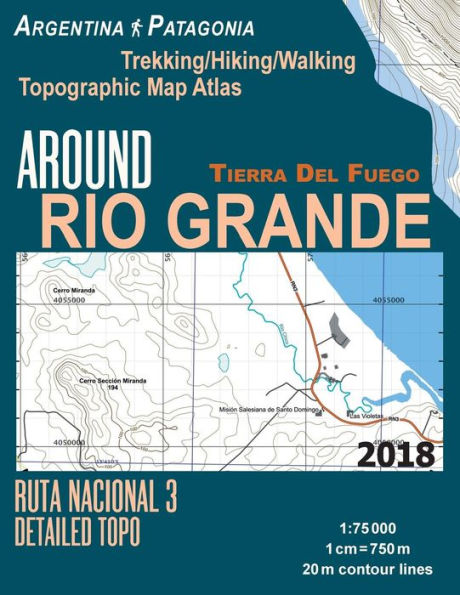
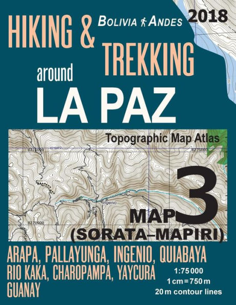
Updated edition. Complete map of the Paparoa National Park and surrounding area, covering great walks and wonderful tramping/hiking trails in the area. Detailed topographic map 1:50.000 & 20 meter contours for hiking and trekking, printed as an atlas book (with overlapping pages).
Pancake Rocks, Punakaiki area, pancake-shaped limestone rocks, blowholes and surge pools; Pororari River, Paparoa Track and Pike29 Memorial Track; Truman Track etc.
20 meter contour lines, road network, trails & paths, transportation, food, campsites, shelters, guest houses & hotels.Mercator projection with both UTM and WGS84 coordinate grids.
The map scale of 1:50000 (1 cm = 500 meters) provides a wealth of detail while keeping low the weight of the atlas itself. The large page format of 8.5x11in minimizes page count and along with an overlapping map design allows for comfortable navigation.
The details included in the topographic maps of this atlas were specifically selected to be useful for trekkers, hikers and walkers of all interests, and make it easy to plan and enjoy both short excursions and hikes as well as long multi-day adventures along the main marked routes and/or adjacent trails and paths, which are also shown on the maps.
With this ultralight atlas you will always have a detailed, reliable, information-rich, battery-independent, shatter-proof map for your adventure.